
Google Photos is finally preparing to add a long-requested feature: the ability to see a map view of all the photos and videos you’ve taken by their location. A third-party application released last year called “Photo Map for Google Photos” enabled this feature, but now Google is making this a native feature.
Google Photos 4.52 started rolling out earlier today on the Google Play Store, and Android developer Alessandro Paluzzi was first to spot the new “Explore Map” feature in the latest version of the app. We also enabled this feature in the latest version of the Photos app. Here’s how it works.
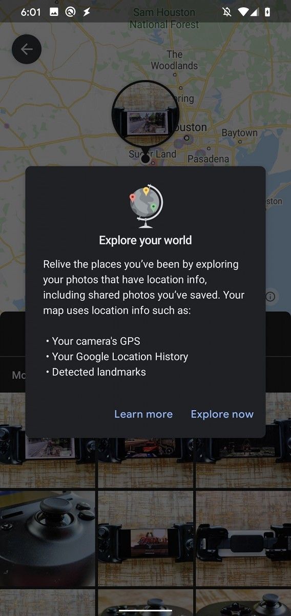
When you open up the Photos app and switch to the “Search” tab, there will be a new map widget underneath the “Places” section. You can either tap on the “Explore Map” button to launch the feature or tap one of the suggested location chips underneath the widget in order to filter photos by that location. If you’re launching the Explore Map feature for the first time, you’ll be greeted by a dialog introducing you to the feature. The feature is designed to help you “relive the places you’ve been by exploring your photos that have location info, including shared photos you’ve saved.” The map uses location info from your camera’s GPS, Google Location History, and detected landmarks (that are seen in the photos themselves.)

You can pan around the map to find other locations where you’ve taken photos. These locations may be marked by a heatmap to show you areas where you’ve frequently taken pictures. For example, Google Photos is showing me heatmaps in Las Vegas, Nevada, as that’s where CES took place this year.


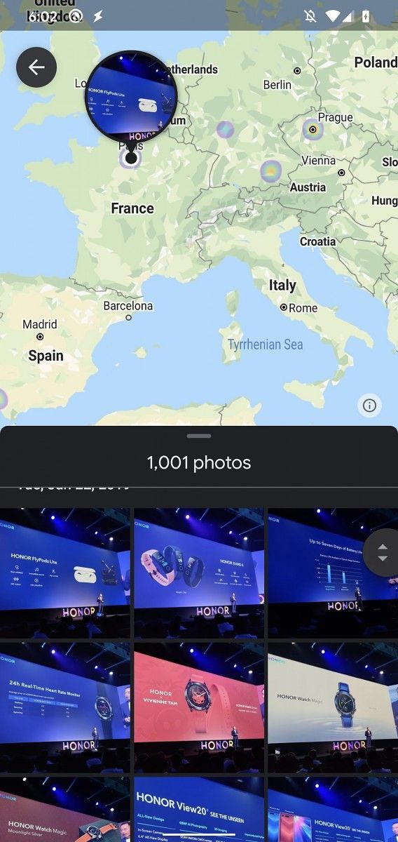

If you tap on an individual photo, you’ll see the map view of exactly where that photo was taken (if location data was saved with the photo).

This feature is fully working in Google Photos version 4.52 but is not yet enabled for users. Once it starts rolling out, we’ll let you know.
Google Photos (Free, Google Play) →
Thanks to PNF Software for providing us a license to use JEB Decompiler, a professional-grade reverse engineering tool for Android applications.
The post Google Photos tests “Explore Map” to view your photos by location appeared first on xda-developers.
from xda-developers https://ift.tt/2BZZ5wf
via IFTTT
Aucun commentaire:
Enregistrer un commentaire